NextGen 2017 is a blended-learning experience for the museum field’s emerging top talent. The program is designed for mid-level staff with three to five years of museum management experience and extraordinary leadership potential as recognized by senior-level executives.
The program blends one week of online learning and one week of residency in a collegial environment at CGU. The curriculum is intensive, while also offering time for self-reflection and practical application of materials and concepts. Participants examine their individual leadership styles, team dynamics, institutional needs and perspectives, and the future of the museum field.
For more information, and to apply, visit: www.cgu.edu/gli
Submitted by Michael VanHartingsveldt, Getty Leadership Institute, October 13, 2017
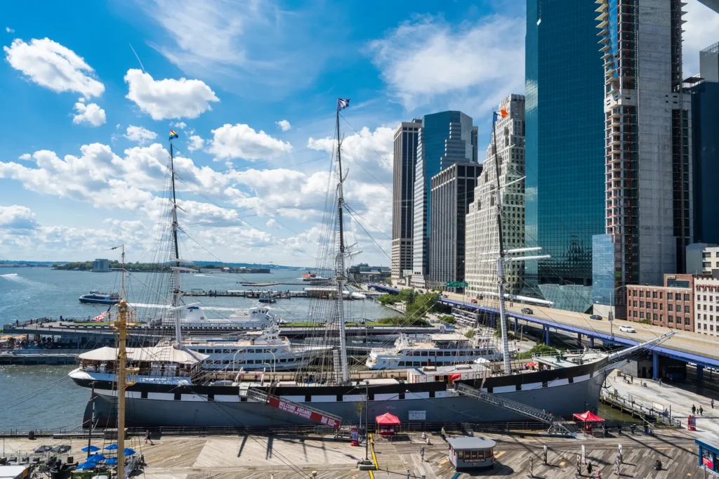
Marifrances Trivelli hands over the CAMM banner to Sam Heed of the Kalmar Nyckel Foundation as CAMM president Dave Pearson looks on. The handover of the banner from the 2015 host, Los Angeles Maritime Museum, to the 2016 host took place during the final dinner of the 2015 CAMM conference.
The 2016 CAMM conference will take place in Wilmington, Delaware, at Kalmar Nyckel Foundation’s new Maritime Center on April 25 – 27. This year’s conference will be extended from two to three days in order to include professional training sessions that will supplement the traditional programming. The 2016 CAMM programming committee is being formed and will soon be issuing a survey to determine the topics of most interest to CAMM members.
CAMM members have created an impressive variety of blogs to highlight their exhibits, collections, and educational resources. They are listed under the “Resources” section of our website. Have I missed any?
Los Angeles Maritime Museum Research Library’s Adventures in American History, a blog for Articles, Book Reviews, Tales and True Stories from Books, Pamphlets, Periodicals and Collections
National History Day (NHD) is a highly regarded year-long educational program for middle- and high-school students that involves them in a competition to prepare a history project on a designated theme, culminating in state and national competitions. Each year, more than 600,000 students, encouraged by thousands of teachers nationwide, participate in the NHD contest. Students choose historical topics related to a specified theme and conduct extensive primary- and secondary-source research through libraries, archives, museums, oral history interviews, and historic sites. After analyzing and interpreting their sources and drawing conclusions about their topics’ significance in history, students present their work in original papers, websites, exhibits, performances and documentaries – either individually or in groups. Students compete in state contests for the opportunity to compete in the national finals held in June at the University of Maryland.
In order to encourage the study of our maritime history, the National Maritime Historical Society offers Special Prizes for maritime-related projects at a number of National History Day state contests. In 2015, NMHS is offering Special Prizes in thirteen state contests.A feature link has been added to the NMHS website at http://seahistory.org/education/national-history-day, which gives an overview of this year’s contests, logistics, suggested maritime topics and a description of the NMHS prizes. NMHS is interested in partnering with other maritime organizations and museums in support of this excellent program.
Submitted by Ron Oswald, National Maritime Historical Society
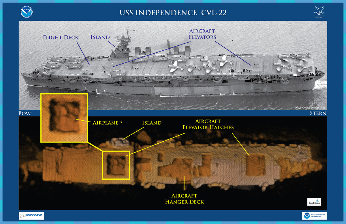
Features on an historic photo of USS Independence CVL 22 are captured in a three-dimensional (3D) low-resolution sonar image of the shipwreck in Monterey Bay National Marine Sanctuary. The Coda Octopus Echoscope 3D sonar, integrated on the Boeing Autonomous Underwater Vehicle (AUV) Echo Ranger, imaged the shipwreck during the first maritime archaeological survey. The sonar image with oranges color tones (lower) shows an outline of a possible airplane in the forward aircraft elevator hatch opening. Credit: NOAA, Boeing, and Coda Octopus
NOAA, working with private industry partners and the U.S. Navy, has confirmed the location and condition of the USS Independence, the lead ship of its class of light aircraft carriers that were critical during the American naval offensive in the Pacific during World War II.
Resting in 2,600 feet of water off California’s Farallon Islands, the carrier is “amazingly intact,” said NOAA scientists, with its hull and flight deck clearly visible, and what appears to be a plane in the carrier’s hangar bay.
Independence (CVL 22) operated in the central and western Pacific from November 1943 through August 1945 and later was one of more than 90 vessels assembled as a target fleet for the Bikini Atoll atomic bomb tests in 1946. Damaged by shock waves, heat and radiation, Independence survived the Bikini Atoll tests and, like dozens of other Operation Crossroads ships, returned to the United States.
While moored at San Francisco’s Hunters Point Naval Shipyard, Independence was the primary focus of the Navy’s studies on decontamination until age and the possibility of its sinking led the Navy to tow the blast-damaged carrier to sea for scuttling on Jan. 26, 1951.
“After 64 years on the seafloor, Independence sits on the bottom as if ready to launch its planes,” said James Delgado, chief scientist on the Independence mission and maritime heritage director for NOAA’s Office of National Marine Sanctuaries. “This ship fought a long, hard war in the Pacific and after the war was subjected to two atomic blasts that ripped through the ship. It is a reminder of the industrial might and skill of the “greatest generation’ that sent not only this ship, but their loved ones to war.”
NOAA’s interest in Independence is part of a mandated and ongoing two-year mission to locate, map and study historic shipwrecks in Gulf of the Farallones National Marine Sanctuary and nearby waters. The carrier is one of an estimated 300 wrecks in the waters off San Francisco, and the deepest known shipwreck in the sanctuary.
The mission was conducted last month using an 18.5-foot-long autonomous underwater vehicle (AUV), Echo Ranger, provided by The Boeing Company through a cooperative research and development agreement with NOAA’s Office of Oceanic and Atmospheric Research. Boeing also partnered with technology company Coda Octopus to integrate its 3D-imaging sonar system, Echoscope, into the AUV.
“Boeing is excited for the opportunity to partner with NOAA to utilize this state of the art technology,” said Fred Sheldon, Boeing project manager for AUVs. “The Echo Ranger is uniquely suited for this type of mission and performed perfectly allowing us to conduct a thorough survey of the USS Independence.”
Scientists and technicians on the sanctuary vessel R/V Fulmar followed the AUV as it glided 150 feet above the wreck and successfully surveyed the carrier’s nearly intact hull. The survey determined that Independence is upright, slightly listing to starboard, with much of its flight deck intact, and with gaping holes leading to the hangar decks that once housed the carrier’s aircraft. To see sonar images, historical photos and other materials, visit http://sanctuaries.noaa.gov/shipwrecks/independence/.
“By using technology to create three-dimensional maps of the seafloor and wrecks like Independence, we can not only explore, but share what we’ve learned with the public and other scientists,” said Frank Cantelas, archaeologist with NOAA’s Office of Ocean Exploration and Research, who joined the mission along with Robert Schwemmer, west coast regional maritime heritage coordinator for NOAA’s Office of National Marine Sanctuaries.
Delgado, primary author of a 1990 scientific report on the history and archaeology of the ships sunk at Bikini Atoll in the Marshall Islands, said currently there are no plans to enter the vessel or survey drums of hazardous and radioactive waste that were dumped in the sanctuary between 1946 and 1970. No trace of the drums or radiation was observed during the mission, Delgado said.
Gulf of the Farallones National Marine Sanctuary encompasses nearly 3,300 square miles of ocean and coastal waters beyond California’s Golden Gate Bridge. The sanctuary supports an abundance of species including the largest breeding seabird rookery in the contiguous United States, and other species such as whales and white sharks.
NOAA’s Office of Ocean Exploration and Research is the only federal agency that advances NOAA and national objectives by systematically exploring the planet’s largely unknown ocean for the purpose of discovery and the advancement of knowledge.
NOAA’s mission is to understand and predict changes in the Earth’s environment, from the depths of the ocean to the surface of the sun, and to conserve and manage our coastal and marine resources.
Submitted by Robert Schwemmer, West Coast Region Maritime Heritage Coordinator, NOAA
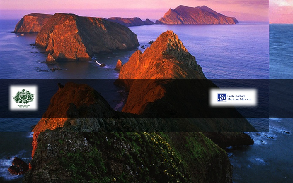
Greg Gorga of Santa Barbara Maritime Museum recently updated CAMM conference attendees on a new film entitled “West of the West: Tales from California’s Channel Islands.” The film will premiere on California PBS stations sometime this spring.
According the film’s website, “the Santa Cruz Island Foundation and The Santa Barbara Maritime Museum are initiating the first ever feature length documentary which tells the story – largely unknown to the public – of the crown jewels of California’s coast – the eight Channel Islands. Told from the point of view of the people who’ve experienced the Channels – lived on, wrecked on, dived under, filmed, raised children, ranched, bootlegged, fished, surfed, sailed, explored and restored – the remarkable story began 13,000 years ago and continues today.”
Greg also mentioned that the film is available to other institutions.
At the recent CAMM conference, many member institutions provided updates on recent activities. Seems like a great new category for this blog! Send your updates (with images if possible) to maritimemuseums@gmail.com
While Somali incidents have dropped 95% to seven cases in 2013, piracy in Southeast Asia is exploding. As you may have heard, 800,000 gallons of diesel was recently pilfered from a large oil tanker in the Strait of Malacca. This area is clearly the world’s new piracy hotspot. Attacks and attempts in the waters of Indonesia have totaled to 107 incidents last year, leading to a 700% increase in just 5 years. To help generate awareness of maritime trade and the law of the sea, Norwich University has created an infographic that addresses the freedom of the seas, security and piracy. As the occurrence of incidents increases by 25% every year, this awareness and understanding of piracy is crucial for it’s recession.
[Submitted by Sarah Song — sarah@circainteractiveseo.com]
Applications are being accepted now for the “Summer Scholar” 2014 National Endowment for the Humanities Institute at Mystic Seaport Museum in Connecticut. The topic of the program, directed by Dr. Eric Roorda, is American maritime studies.
These NEH programs pay $3,900 for 5 weeks of participation in a gorgeous part of the country.
Participants can be full or part time faculty or graduate students. In our past NEH programs in Mystic, we’ve had scholars from many different disciplines, such as History, Literature, Theater, Philosophy, Geography, and Spanish.
The World Ocean Observatory has announced the launch of World Ocean Journal, a new bi-annual e-zine on ocean culture, issues and solutions to today’s ocean issues. The inaugural volume includes essays, interviews, art, exhibits and performances which profile some of the vital impacts of the ocean on our lives. The last essay, by director Peter Neill, contains his “reflections on ‘reciprocity’ as a rationale and framework for exchange of value and engagement between the ocean and us, between civil society and the natural world that sustains it.” For more on the journal’s content, click here.
The mission of the World Ocean Observatory is to provide a place of exchange about the ocean as defined as “an integrated, global, social system” relating the ocean to fresh water, climate, science, food, technology, finance, policy governance, coastal development, planning, and cultural traditions. World Ocean Journal, a new outreach effort by the World Ocean Observatory, is yet another extension of our efforts to educate the public, broaden our audience of Citizens of the Ocean, and present information and educational services as dynamic as the ocean itself.
I have recently created two new resource pages on the CAMM website. These public pages are intended to assist researchers and educators in using your online resources. Research Links provides links to information about your research collections and online tools for using those collections. Educational Materials is intended to assist educators find online tools for teaching maritime history. Aside from teacher training opportunities, this listing does not include programs offered at your facility but rather online curriculum and other resources that can be used offsite. I gathered these links by perusing your websites. Please let me know if I have overlooked a link that should be included.
A related resource page, Ship Plans Directory, has also been developed based on the survey forms many of you filled out last summer. Additional collections may be added by filling out the CAMM Ship Plans Survey form and returning it to my attention.